

Paso Robles is an incorporated city in northern San Luis Obispo County, on US Highway 101 with State Route 46 running east and west from town. It began as a hot springs destination, grew up around a downtown street grid laid out in the 1880s, and shares its name with the Paso Robles wine region that surrounds it.
For buyers, Paso Robles real estate starts with two questions. Is the home inside city limits or in unincorporated San Luis Obispo County? And is it on the older west side of the Salinas River or in the neighborhoods that grew to the east? The answers change who provides water and sewer service, who issues permits, which rules apply to wells and septic systems, and what kind of neighborhood you will be living in.
What Is It Like to Live in Paso Robles?
Paso Robles grew from a hot springs town into an agricultural center and, over the 20th century, a wine destination. According to the City, the first train arrived on October 31, 1886, a land auction sold 228 lots a few weeks later, and Paso Robles incorporated in 1889.
Downtown City Park is still the center of town. The City calls it the heart of the community, surrounded by restaurants, wine tasting rooms, and small businesses, and its bandstand dates to 1890. Spring Street is the historic spine of downtown.
The Salinas River runs through the middle of the city from south to north. Together with Highway 101 and the Union Pacific rail line, it divides Paso Robles east to west, and that line explains a lot about how the city grew.
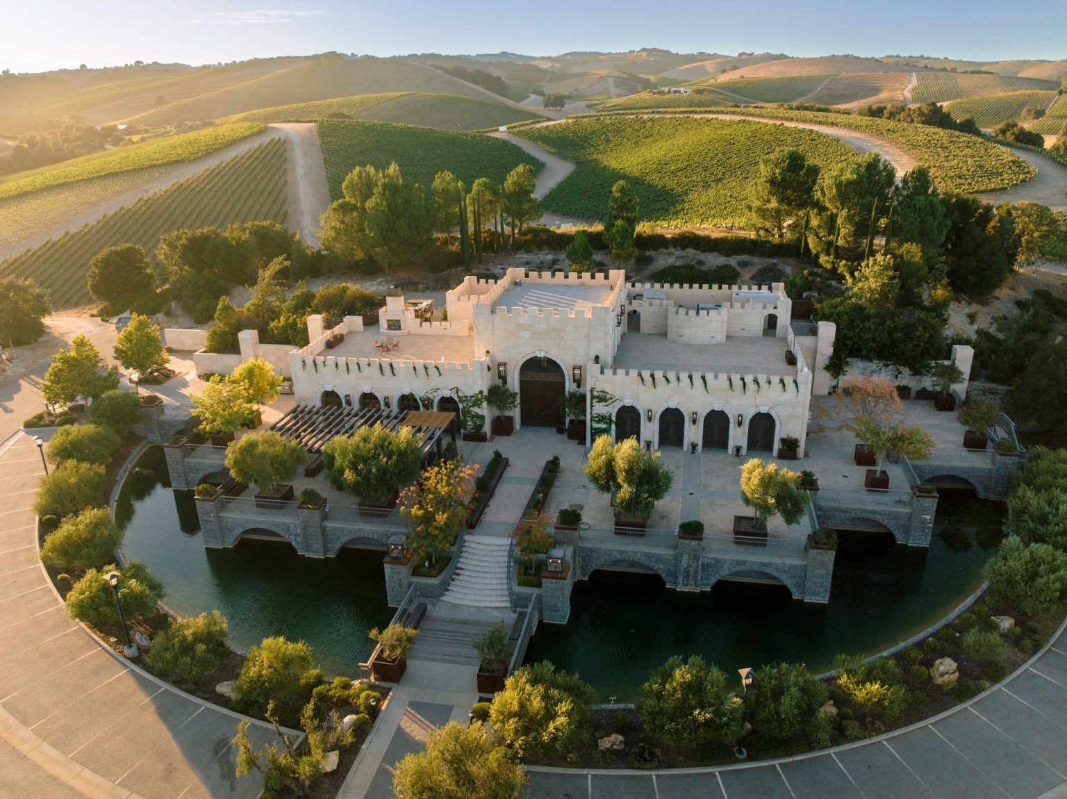
The wine region and the city are not the same thing. The Paso Robles American Viticultural Area, federally recognized in 1983, lies within San Luis Obispo County, and in 2014 it was divided into 11 smaller districts, including the Adelaida District, the Templeton Gap District, and the Paso Robles Estrella District. The Paso Robles Wine Country Alliance counts more than 200 wineries across the region. A home surrounded by vineyards may be inside the city or on county land, so the setting alone does not tell you which rules apply.
Through the year, the California Mid-State Fair takes over the Paso Robles Event Center each July, and the City’s Concerts in the Park series brings Thursday evening music to Downtown City Park in summer.
Paso Robles Neighborhoods and Residential Areas
You will often hear Paso Robles described by its west side and east side. The City’s planning documents divide Paso Robles at the river, the highway, and the rail line, and they name areas by their specific plans rather than by neighborhood names. The cards below use those official plan names where they exist. Directional names are plain descriptions, not official boundaries.
Downtown and the Historic West Side
West of the river is the older part of Paso Robles. The City’s Uptown/Town Centre Specific Plan, adopted in 2011, covers about 1,100 acres here. Its Town Centre area runs from Vine Street to the Salinas River between 1st and 24th Streets, and Uptown continues north of 24th Street.
Homes here sit on or near the original street grid, close to downtown. The City identifies Vine Street as an area of historic interest. If you’re considering an older home, confirm whether any historic-preservation requirements apply before planning exterior changes.
East of the Salinas River
East of the river, Paso Robles grew through annexation. The City dates that growth to Sherwood Acres, the city’s first airfield, annexed in 1952, followed by the Orchard Tract in 1957. Later annexations brought in the Olsen Ranch and Beechwood areas in 2004.
Today the east side includes neighborhoods built over several decades, larger planned subdivisions, and the newest planned areas in the southeast corner of the city. Age and lot size vary from street to street, so compare each property on its own terms.
River Oaks
River Oaks is inside city limits, east of the Salinas River and north of Highway 46, within the City’s Borkey Area Specific Plan, first adopted in 1990. The River Oaks master plan for that part of the plan area was adopted in 1999, and the River Oaks Hot Springs Spa is nearby.
The City’s 2026 development update describes the Traditions section as age-restricted housing for residents 55 and older, alongside a larger-lot section called the Reserve. If you are thinking about downsizing, my article Downsizing in Paso Robles covers what to look for in a smaller home. For homes currently available in River Oaks, contact Wina Gill.
Newer Planned Communities in the Southeast
Two City specific plans guide new residential growth in southeast Paso Robles. Olsen-South Chandler Ranch, bounded by Sherwood, Fontana, Linne, Hanson, and Meadowlark Roads, received final City approval in February 2020 for 1,293 residential units on 356 acres. The Beechwood Specific Plan, approved in October 2020, covers 234 acres in the southeast corner of the city and includes 911 residential units. North Chandler Ranch has been annexed but still needs its own specific plan.
Approval is not the same as availability. A specific plan sets what may be built, not when homes will be offered or at what price. If you are interested in new construction here, contact Wina Gill to talk through what is being offered and what to review before you commit. Ask early about homeowners association dues and Community Facilities District (Mello-Roos) special taxes, which the City has established for parts of the Olsen-South Chandler Ranch area.
Rural and Wine-Country Properties Outside City Limits
Many buyers come to Paso Robles for acreage, vineyard land, or a home in the hills. Rural parcels outside city limits are governed by San Luis Obispo County, not the City. County Planning and Building handles permits there, and a home that is not connected to a water or sewer provider relies on a private well and an onsite septic system. Confirm what serves the specific property.
Some farmland in the county is under a Williamson Act contract, which the County administers and which reduces property taxes for owners of farmland and open-space land. Contracts run for 10 or 20 years and renew each year, so ask whether a parcel is enrolled before you plan changes to how the land is used.
A Paso Robles mailing address does not by itself confirm that a property is inside the city. Check jurisdiction for the specific parcel before you rely on City services or City rules.
Inside City Limits or Unincorporated County?
This is the first thing to confirm on any Paso Robles property, because it decides who you call for almost everything. The lists below describe the general pattern; confirm the services for the specific address.
Inside the City of Paso Robles
- Planning and permits. The City’s Community Development Department applies the City Zoning Code, Title 21 of the Paso Robles Municipal Code.
- Water. The City supplies water to its water customers. In a normal year, more than half comes from seven shallow wells along the Salinas River corridor, supplemented by the Nacimiento Water Project and the Paso Robles Groundwater Basin.
- Sewer. The City’s Wastewater Division operates 126 miles of sewers and the City’s wastewater treatment plant.
- Fire and police. Paso Robles Fire and Emergency Services and the Paso Robles Police Department.
In Unincorporated San Luis Obispo County
- Planning and permits. San Luis Obispo County Planning and Building.
- Water and wastewater. Depends on the property. Some rural homes rely on a private well and septic system, and others may be served by a water or sewer provider. Confirm the source and system for the specific property.
- Fire and law enforcement. CAL FIRE serves as the County Fire Department under contract with the County, and the County Sheriff’s Office serves unincorporated areas.
Water, Wells, and Septic Before You Buy
Water deserves extra attention in Paso Robles. San Luis Obispo County describes the Paso Robles Groundwater Basin as a high priority basin subject to critical conditions of overdraft, and the basin is managed under a state-required groundwater sustainability plan.
- Private wells. The County notes that water quality from private wells is not regulated or monitored by any outside agency. Testing and maintaining a private well is the owner’s responsibility, so plan to test water quality and review well records before you close.
- Groundwater rules. Rules for pumping, metering, and adding new water use in the basin can change, and they can depend on the parcel, how the water is used, and what you plan to build. If you are considering a property with a well, acreage, a vineyard, or plans for future development, confirm current requirements with the County and the groundwater management authority for that area. The County’s Paso Robles Groundwater Basin and new construction water requirements pages are good starting points.
- Septic systems. In unincorporated areas, the County oversees septic systems through its Local Agency Management Program). A septic inspection is worth including in your due diligence.
- City homes. Confirm the water and sewer connections for the specific address. For older homes, a sewer lateral inspection is an optional step to discuss with your inspector.
Schools Serving Paso Robles
Paso Robles Joint Unified School District serves the city. The district assigns students to a school within an attendance area based on their residential address, and it notes that no school placement is guaranteed. Use the district’s attendance boundary lookup for a specific address.
Several other districts operate in North County, including Templeton Unified, Atascadero Unified, Shandon Joint Unified, San Miguel Joint Union, and Pleasant Valley Joint Union Elementary. For a rural address, confirm the district before you rely on it.
Fire, Flood, Zoning, ADUs, and HOAs
Fire Hazard Severity Zones
California’s State Fire Marshal released updated fire hazard severity zone maps for incorporated cities on March 10, 2025, and the City of Paso Robles publishes its own fire hazard severity zone map page and FAQ. Check the zone for a specific parcel before you buy, since it can affect building standards for the property. My article What San Luis Obispo County’s New Fire Hazard Zones Require explains what changed.
Flood Zones
The City’s Safety Element notes flood hazards from the Huerhuero Creek, Dry Creek, and Salinas River floodplains. Look up the specific property on FEMA’s Flood Map Service Center and ask your lender whether flood insurance will be required.
Zoning and ADUs
Inside the city, zoning comes from the City Zoning Code and can be checked on the City’s interactive map. Outside the city, use the County’s Land Use View. The City accepts San Luis Obispo County’s pre-approved ADU plans, which can simplify an accessory dwelling unit project. Confirm what a specific lot allows before you assume a project is possible.
HOAs and Special Taxes
Many planned neighborhoods have a homeowners association. California law requires the seller of a home in a common interest development to give a prospective buyer copies of the governing documents before the sale, so review the CC&Rs, budget, and any special assessments early. Check the property tax bill for Mello-Roos or other special taxes as well. San Luis Obispo County’s documentary transfer tax is $1.10 per $1,000 of value.
Paso Robles or a Nearby Community?
Paso Robles vs. Templeton
Templeton, just south of Paso Robles, is an unincorporated community governed by San Luis Obispo County under its own community plan and served by Templeton Unified School District. Read more on my Templeton page.
Paso Robles vs. Atascadero
Atascadero, farther south along Highway 101, is its own incorporated city with its own planning department and school district, Atascadero Unified. Read more on my Atascadero page.
Paso Robles vs. Arroyo Grande
Arroyo Grande is an incorporated city in South San Luis Obispo County, served by Lucia Mar Unified School District. If you are weighing inland North County against South County, closer to the coast, see my Arroyo Grande page and my comparison Arroyo Grande vs. Paso Robles.
What I Tell Buyers About Paso Robles
Start with the map, not the photos. Before you fall for a view, confirm whether the parcel is in the city or the county, where its water comes from, and whether HOA dues or special taxes come with it.
In town, the bigger choice is between the older grid near downtown and the planned neighborhoods east of the river. Outside town, the well, the septic system, and the basin rules deserve as much attention as the house itself. Get those answers early, and choosing the right home gets a lot easier.
Frequently Asked Questions About Living in Paso Robles
Is Paso Robles in San Luis Obispo County?
Yes. Paso Robles is an incorporated city in northern San Luis Obispo County. It incorporated in 1889 and sits on US Highway 101, with State Route 46 running east and west from town.
What is the difference between the west side and east side of Paso Robles?
The Salinas River, Highway 101, and the rail line divide the city east to west. The west side holds downtown and the original street grid from the 1880s. The east side grew through annexations beginning in the 1950s and includes River Oaks and the newer planned areas in the southeast.
Is River Oaks inside Paso Robles city limits?
Yes. River Oaks is within the City’s Borkey Area Specific Plan, east of the Salinas River and north of Highway 46. Confirm details for any specific parcel.
Are there 55+ communities in Paso Robles?
Yes. The City describes Traditions at River Oaks as age-restricted housing for residents 55 and older, and its plans for Olsen-South Chandler Ranch also include age-restricted lots. For what is currently available, contact Wina Gill.
Are new homes being built in Paso Robles?
The City has approved two large specific plans in the southeast, Olsen-South Chandler Ranch and Beechwood, both in 2020. Approval does not mean homes are available today. Contact Wina Gill to talk through current new-construction options.
Do newer Paso Robles neighborhoods have Mello-Roos taxes?
Some do. The City has established Community Facilities Districts for parts of Olsen-South Chandler Ranch and other developments have been annexed into its public services district, CFD 2005-1. Check the property tax bill and disclosures for the specific home.
Who provides water and sewer service in Paso Robles?
Inside city limits, the City provides water and sewer service. Outside city limits, it depends on the property, and some rural homes rely on a private well and septic system. Confirm the providers for the specific property.
What should I know about buying a Paso Robles home with a well?
The County notes that private well water quality is not regulated or monitored by any outside agency, so test the water and review well records. The Paso Robles Groundwater Basin is managed under a groundwater sustainability plan, so confirm current requirements with the County before you plan new water use or construction.
Which school district serves Paso Robles?
Paso Robles Joint Unified School District serves the city and assigns schools by residential address. Rural addresses may fall in another district, such as Templeton Unified or Shandon Joint Unified, so confirm the district for the specific address.
Can I build an ADU on a Paso Robles property?
It depends on the lot. The City accepts San Luis Obispo County’s pre-approved ADU plans, and rules differ inside and outside city limits. Confirm what the specific parcel allows with the City or County before you plan a project.
Explore Paso Robles Homes
Start with how you want to live. Decide whether you want the older streets near downtown, a planned neighborhood east of the river, or land outside town, and whether city services or a well and septic system fit your plans.
Then look at the home itself: its age and condition, any HOA or special taxes, and whether it is in the city or the county. Once we know that, we can focus on the right part of Paso Robles and move quickly when the right property comes up.
Own a Home Here? Selling a Paso Robles Home →
Wina Gill, Realtor® | Certified Negotiation Expert
Century 21 Masters Luxury
San Luis Obispo County & North Santa Barbara County
DRE #02006343
Paso Robles Market Snapshot
Use the current market snapshot to understand how today’s Paso Robles listings fit into the broader market.



Get In Touch
805-550-0161
DRE #02006343
©2026 All rights reserved. CENTURY 21®, the CENTURY 21 Logo and C21® are service marks owned by Full Realty Services Inc. DBA Century 21 Masters fully supports the principles of the Fair Housing Act and the Equal Opportunity Act. Each office is independently owned and operated.
